Where is my group?...
Live Map - show your group whereabouts on a piste-map...
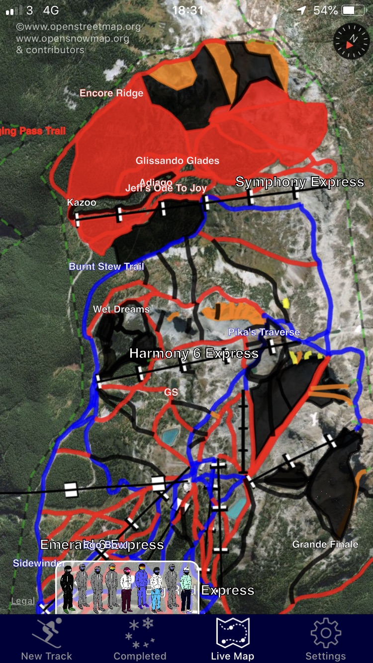
With the SkiMax Multi-pass, (In App purchase required) you can see your group members’ locations, displayed on an animated piste-map of your ski resort. This makes it easy to know where your group is, and where they might be heading. Gone are the days of attempting to make copious phone calls to find our where your group might be. Just check them out on the Live Map. Piste map coverage is Global, but not absolutely comprehensive. Check with the Open Snow Map project for the full coverage offered.
Map Types
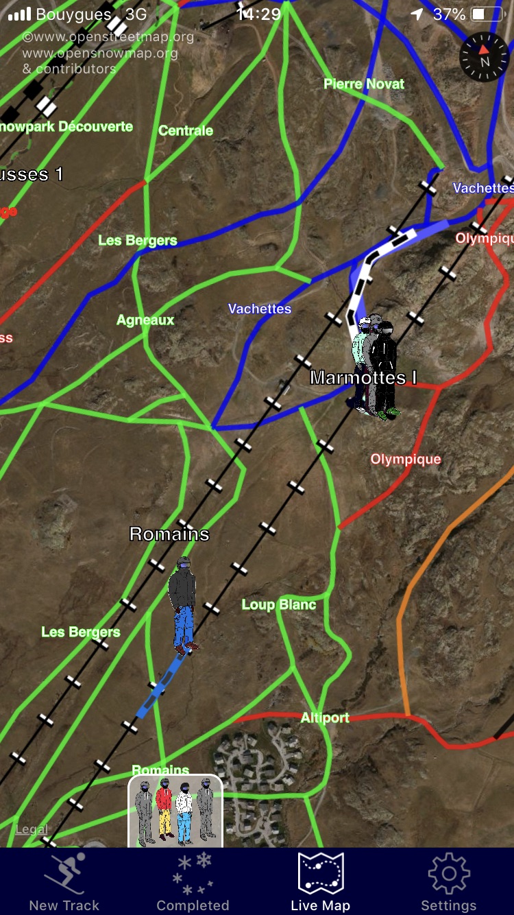
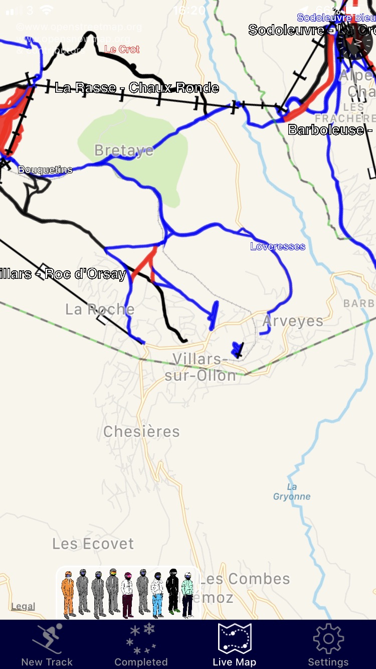
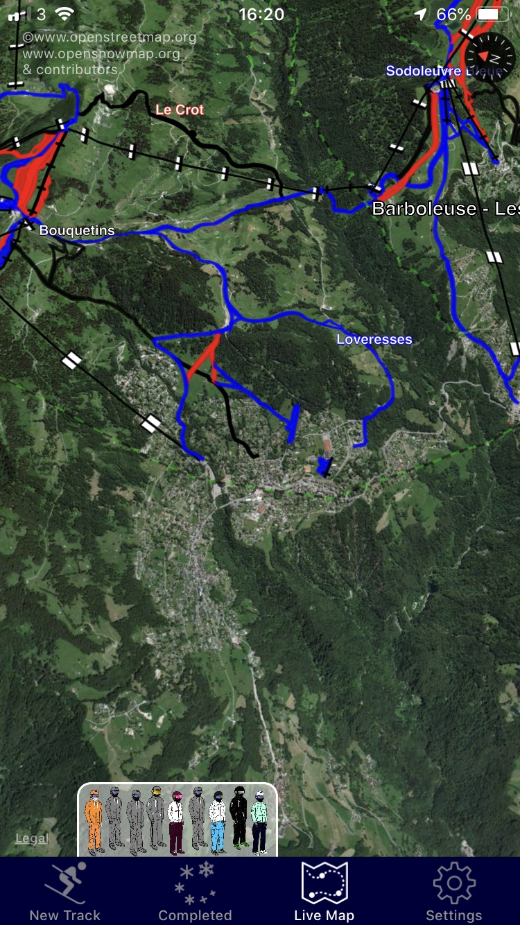
The Live Map may be viewed in one of three possible formats. These are pretty standard Apple map formats: Map; Hybrid and Satellite. Both Hybrid and Satellite map types present data with added height effects to make mountainous areas more vivid. The images below show the same areas represented within the three possible map types.
Map
Hybrid

Satellite
Settings for your Live Map, and other SkiMax maps...
The Settings tab contains a number of switches that affect the operation of the map. It is important to understand what these do.

The simplest, MAP type, presents information on a standard 2D Apple map view. Both Hybrid and Satellite map types present data in Apple’s ‘flyover’ view. This allows you to change your perspective and see the relief of the landscape. These settings affect the appearance of ALL map pages used in SkiMax.
The Bench...
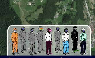
When you are subscribed to Group data, and SkiMax has been unable to determine the whereabouts of members in the group, these, members are shown on the bench… This just means that a recent location for this member is not currently available. This may be because the user is currently out of cellular data contact, or, it may just means that they are not using SkiMax at the moment. Either way, if a location cannot be determined for them, they are shown on the Bench. A location is considered to be recent if it is within the last 10 minutes.
Compass Mode

Compass mode adjusts the map view, and places you right in the middle. Here, holding the map flat and rotating it around, the map will be aligned and configured to rotate like a compass. Pointing it at a certain object in the real-world and you should be able to see that object on the map in the map-world. It’s pretty intuitive once it's set up. If, at any time, you pan the map manually so that you are no longer in the middle, then the compass feature is disabled and the re-centre icon appears. Pressing the re-centre icon will bring you back to the middle and re-enable the compass mode. While in Compass mode, AutoZoom is disabled.
Special Map features...
The settings tab contains some additional feature switches that change the way the Live map works.
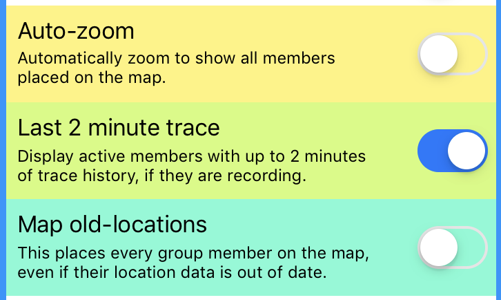
Auto Zoom
This switch enabled automatic zooming of the map to show all current members. If you are running without Group features, or are skiing solo, then this switch will zoom to show your current location, with you centred in the middle of the map. If skiing with a group with Group features enabled, every time SkiMax receives new location data for your group members, it will re-zoom the map.
Usage tip, if you begin to pan around, zoom in, or out away from the auto-zoom area, then expect for the map to jump you back again within 15 seconds. We recommend that you set this switch initially, allow the first auto-zoom to take place, and then switch it off so that you have more control over the area that the map displays. Only members of your group for which location data is known will be shown on the map (unless you switch Map-old-locations, see later). Auto-zoom will then zoom to the right area, and size, to completely show all avaiable ski-group members.
Last 2 minute trace
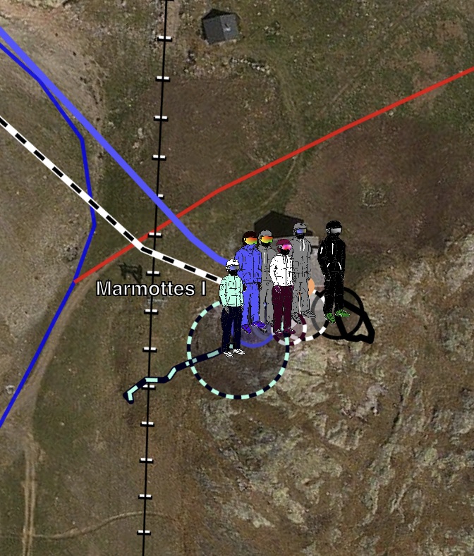
For all people in your Group that are currently recording a track, and are in communication range, SkiMax will display their locations, and augment their location with a two minute trace, showing the whereabouts for the last two minutes. If they are in your group and NOT recording a track, then SkiMax will just show their location without a two minute trace. If SkiMax cannot determine their location, then they are bumped to the bench (see earlier discussion on the bench). Traces are shown in the two-tone colour scheme for the member. - So it pays to where very bright and contrasting ski-clothes, if you want to stand out. To be found by SkiMax, a group member MUST BE RUNNING SkiMax. (They do not necessarily need to be recording a track.)
Map old-locations
If you are just really desperate to show all the members on the map, regardless of how-old their location data might be, then use this switch. The latest location of every member will then be displayed on the map. Be careful, there will be no indication of whether this data is old or not, so don’t rely on this data being valid. Always switch this off when you need more accurate information.
Accuracy Circles...

Members are always shown on the Live map with a circle of accuracy around them. (See image on side/below.) These will also be drawn in the colour-scheme of the members being represented. It allows you to know if a particular location is being given with a very low accuracy (larger circle), or if the location is more precise, (smaller circle). Accuracy circles are always shown on the maps where known.
Customising your Piste Map...
Piste map data can be completely disabled, if desired by switching off Piste-Maps in settings. This can be useful if you wish to de-clutter your Live Map, or simplify the appearance of your historical tracks. Either way, the Piste-Maps switch is the big 'on/off' switch for all your piste map data.
The rest of the buttons and switches only make a difference when the piste-map is ON.
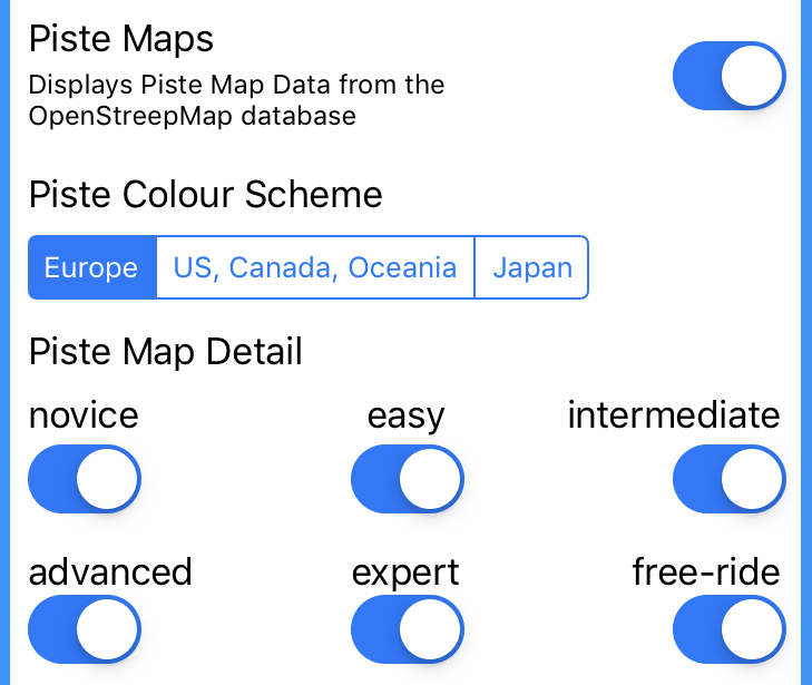
Europe
US, Canada and Oceania
Japan
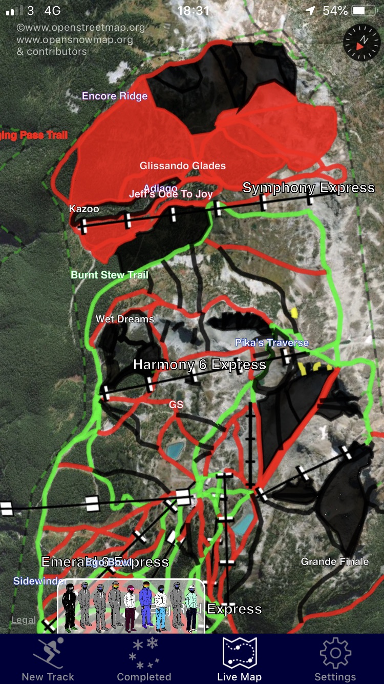
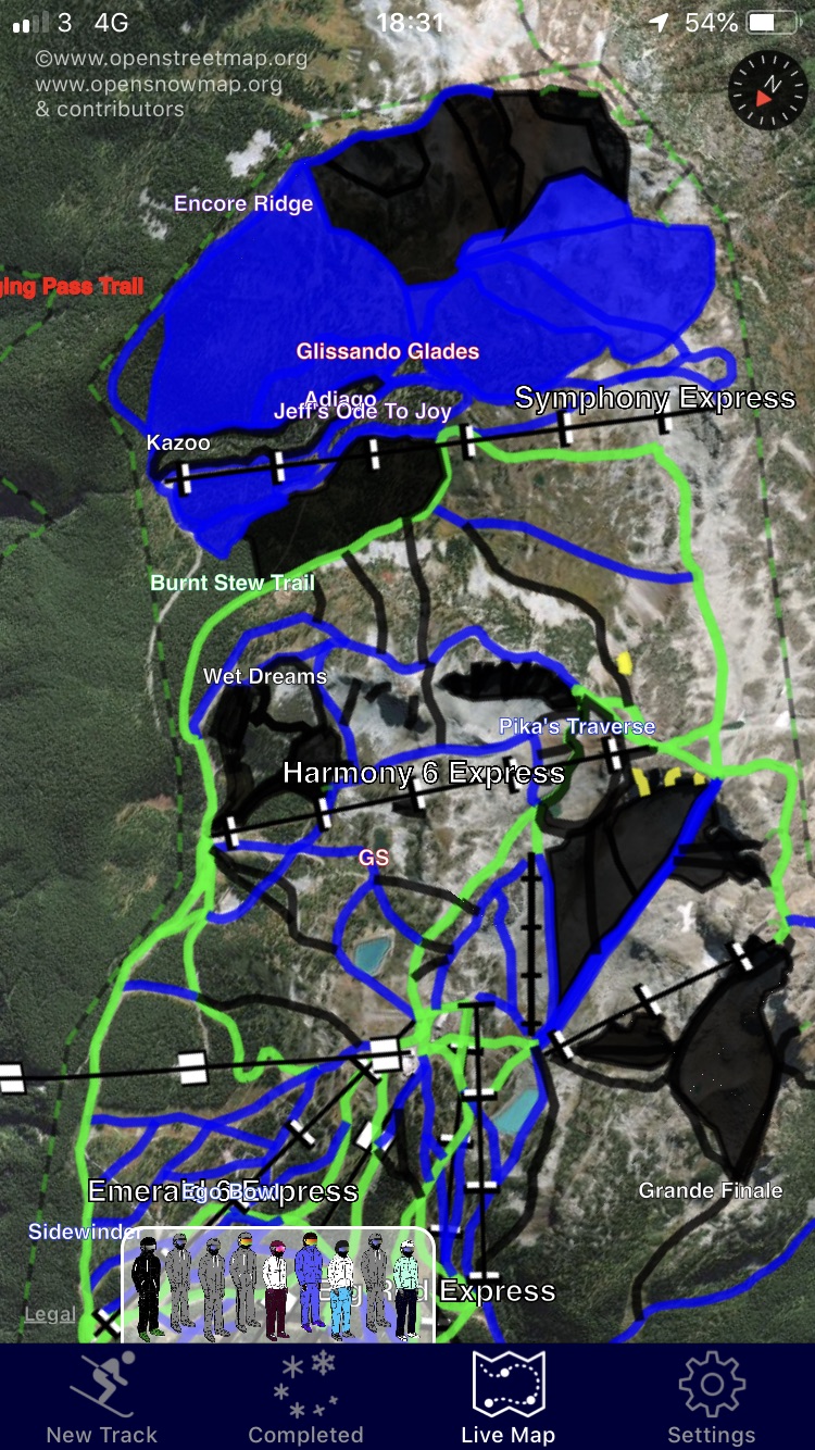
Piste Map Detail
The settings tab contains some additional feature switches that change the way the maps display Piste Map data. The remaining six switches allow you to enable or disable pistes or areas of different levels of difficulty. This really allows you to home in on area of the restore that are of most interest to you. Don’t forget, SkiMax presents this data under license from the Open Snow Map project and as such the data can be edited by anyone. Whilst this is an incredible source of information, it should always be verified by consulting officially published piste-map data for the resort you are visiting. Never solely rely on data presented by SkiMax, and always verify. The SkiMax startup-warning should be understood at all times.
SkiMax Piste-Data Warning
At startup, the SkiMax application shows a warning regarding the use of piste-map data shown in the application. (after In App purchase of piste-map data)...
That warning is replicated below...
WARNING
Piste Map data presented in this App may be edited by anyone granted access in OpenStreetMap/OpenSnowMap. Errors and omissions are likely to appear. NEVER solely rely on data presented, or assume that pistes and routes shown are open, fit to use, categorised correctly, or even exist at all. Always consult with Piste maps officially published by resorts and follow locally applied controls for closures and lift opening times. Lifts are shown animated as moving. This is their default appearance and does not indicate that they are open. Always consult local information.
Licence Credits
Piste Map Data is kindly maintained by the Open Street Map Project and contributors and is used with permission under their OBDL Licence ©www.openstreetmap.org and contributors and www.opensnowmap.org

Copyright © 2019 Just-the-Biz Limited.
All rights reserved.